This is a very simple question that I wish was a simple rule of ‘x dollars per acre’, but there are so many different factors to consider in determining land value. Let’s take the following example in the community that one of our agents currently lives in, of Dover, New Hampshire. Here are three lots that are all about 50 acres:
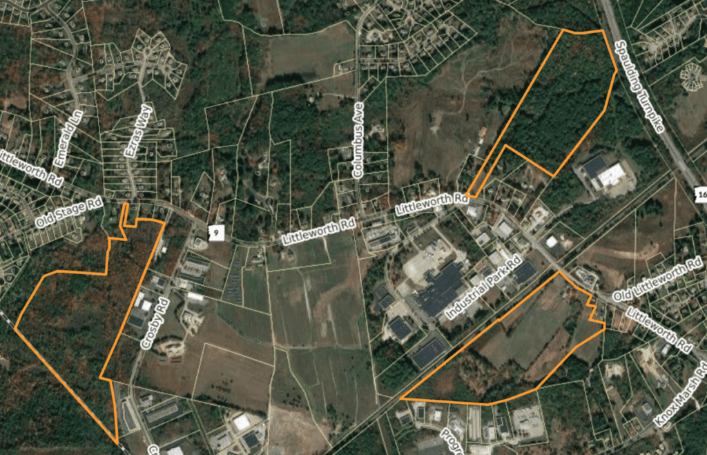
All these sites are relatively flat, are either raw wooded land or cultivated by an old farm, and have little to no structures on them. These all have access on the same road of Littleworth. It would be understandable why most people would think that these three properties should have similar values.
Now let’s look at these three lots through a Zoning Map view:
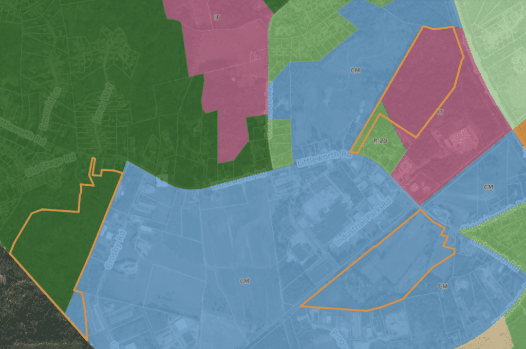
Umm… What the heck just happened? How could three similar sized lots on the same road and within a few minutes walk be in three (technically four) different zones. Not only that, but one is residential with a small section in the Commercial Manufacturing Zoning and the other lot has a right-of-way in a different residential zone than the Innovated Technology District. And you may tell yourself that ‘I have an idea of what I can do in a residential zone and a commercial manufacturing zone‘, but what is allowed in the “Innovative Technology District”?
In these three different zones you have:
- Three different maximum lot coverage ratios (how much of a property can be covered by a building – including or not including outdoor storage or parking)
- Three different maximum height requirements
- Setbacks
- Frontage minimums
- Allowed uses
It is a popsicle headache trying to think through all these permutations for someone who does not deal with this on a daily basis.
This can be complicated by itself, to figure out what is allowed “by right” and how much of the site can be used on a legal basis. Each town is different and lets property owners easily (or not so easily) make changes to zoning to allow certain uses. These changes are called variances and there are five criteria in order to grant the variance:
- The variance will not be contrary to the public interest
- Special conditions exist such that literal enforcement of the ordinance results in unnecessary hardship
- The variance is consistent with the spirit of the ordinance
- Substantial justice is done by granting the variance
- Granting the variance will not diminish the value of surrounding properties
Also, depending on the community you are working with, getting something approved may take weeks to months or even years in some town and city approval processes. Understanding this and the potential risks is really important in determining value.
This is just zoning we are talking about at this point. Other factors such as wetlands, impacted areas, soils, elevation change, proximity to roads and highways, public utilities, and construction costs have just as much influence on determining value as zoning.
So when thinking about how to determine value, seeing what a similar sized property sold for down the road may not be an accurate way to determine value. Without someone who has experience and expertise in land development, you could be priced way too high or possibly way too low.
Zoning Impacts Communities
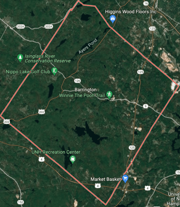
Zoning regulations impact what neighboring properties are each worth, but also impact the nature of the community. Towns with very little area planned for commercial development will have more rural communities. A neighboring town to Dover, such as Barrington, has over 75% more land, but devotes less than 20% of that land for commercial and none for higher density residential. That is a factor in why the Barrington community, that is almost as close to the coastal communities like Portsmouth and Kittery, ME, has a population of less than 10,000, whereas neighboring, similar sized communities like Rochester or Dover with close to half the land both have over 30,000 people.
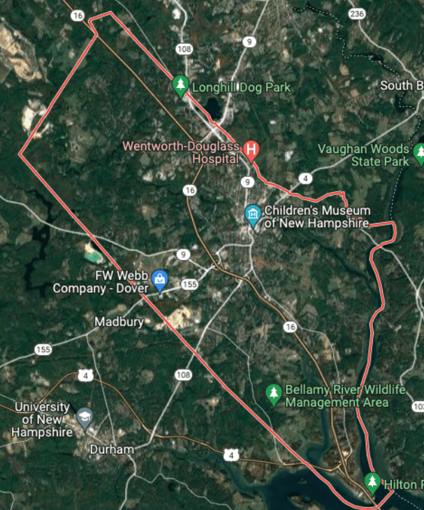
This is not right or wrong – many people don’t want to live in communities that have high population or traffic. It is also fine that some communities have many different zones that have very limited types of uses on the properties. A good zoning map and ordinance can create distinct areas where people work versus live and keep certain areas much more habitable to wildlife and outdoor recreation. Sometimes, however, the increase in traffic requires that zoning changes be handled. At some point in our region’s history, zoning was not a real necessity.
History of New England Zoning
Let’s take a look back at how zoning originally started in New England. Before 1915, there was no uniform way to mark through-ways. New Hampshire had existing pole marking schemes, though these used to vary between all other states. In 1908, the New York legislature had laid out 37 routes slated for maintenance solely by the state, but there was no proper numbering until 1924. In 1915, the Massachusetts Highway Commission proposed to the New England states and New York to adopt a uniform pole marking scheme and all the states agreed to the system, though New Hampshire and Vermont stipulated that these routes would not replace their existing systems.
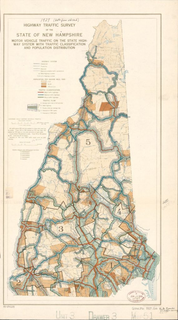
In April 1922, delegates from the New England states met at a dinner conference hosted by the Automobile Club of America to coordinate a new system. Soon thereafter, the system was approved by the highway commissions of all the states involved, and signing began soon thereafter.
Through traffic, an area is influenced and has a huge effect on the demand of the surrounding area for both housing and businesses along the way – which could have a positive or negative effect on the value of the land. It’s important to note, that increasing traffic in an area also requires higher type improvements on the roads and routes. Towns and cities often account for the upcoming changes when a new subdivision gets approved in order to accommodate increasing traffic and this is factored into land pricing and development.
Zoning Amendments
Zoning amendments often come into play with land and development valuation because towns must continue to adapt to the changing traffic, population growth, and business needs of a community. To learn what the best thing is for your community or your property(s), you should talk to a professional who deals with these issues on a daily basis. Reach out to your local zoning or planning board, code enforcement officer, or a commercial real estate professional who specializes in land development.
As we can see from the recent survey data, the population in New Hampshire keeps growing year after year.
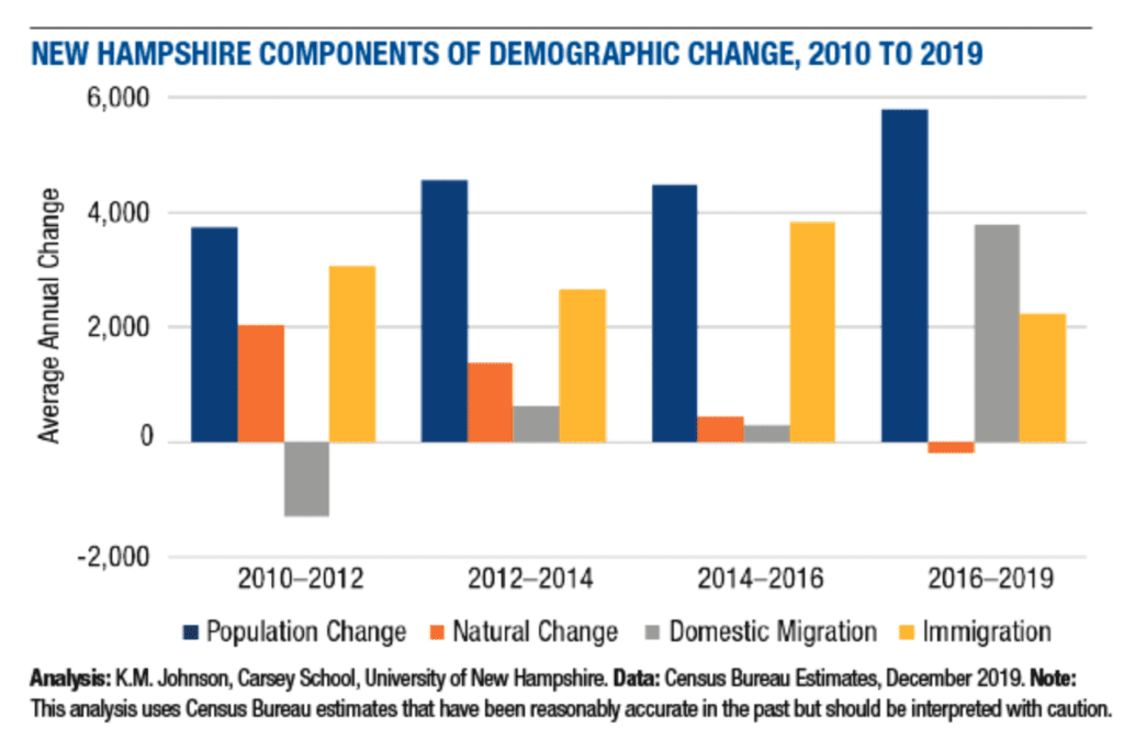
Do we expect this trend to change at some point in the future? For any community it is impossible to grow if there is no upcoming supply of new housing – providing a place for people to move into. These days everyone is worried about housing affordability and, at the same time, everyone is worried about maintaining the current culture of their town – so there’s always opposing dynamics to balance.
If your property is about to get affected by the zoning changes, we’d be happy to help look for potential upside so you’re aware of all the factors to consider and can potentially benefit from these changes.
-Ethan Ash & Viktoria Alkova
